Categories
Milestones Events Projects

Put Your Pub on the Map!

Put Your Pub on the Map!

Welsh Gov’s Welsh map can be edited by You…

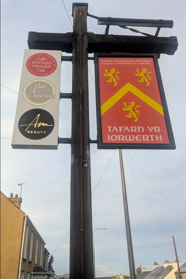
If you believe that your local is the best local, or that the new extension-on-the-extension of your pub needs to be on the map, this is your opportunity to make sure it’s there for all to see.  OpenStreetMap is the Wikipedia of the mapping world, and a Welsh project is now eager for people in Wales to put their pub on their Welsh version of the map.  One of the first pubs to be added already is Tafarn yr Iorwerth on Ynys Môn…

Saturday 9th March saw Welsh Government’s ‘Mapio Cymru’ [Mapping Wales] project organise a day of sharing good practice and conversation in Tafarn yr Iorwerth (previously known as the Iorwerth Arms) in Bryngwran on Sir Fôn.  The location was chosen as it recently had its Welsh name added to Mapio Cymru’s openstreetmap.cymru, the official Welsh-language online map of Wales, an important part of the national Data Map Wales project.

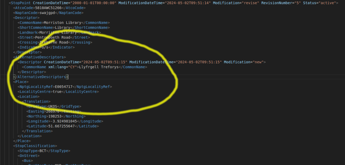
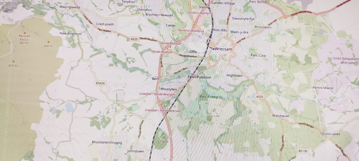
‘Mapio Môn’ was an opportunity for mapping enthusiasts to meet up to see what can be done to improve the provision of Welsh-language names on maps.  Experts from the Welsh Place-name Society, Transport for Wales and from the community-run pub Iorwerth Arms itself shared ideas which could support the long-terms aim of Mapio Cymru – i.e. to make Welsh-language data equal in quality and quantity to the English-language data already available for Wales.  This data could then be used freely in future mapping apps and services from any provider; across education, tourism, fitness, gaming, sustainability, and public services.

Welsh place-names have been a hot potato in Welsh-language heartlands, however Ordnance Survey use the official Welsh-language names too, as Steve Roddick, Welsh Place-name Society member Steve Roddick explained on Saturday:

“The Cable Bay name will be recorded, but it’s in the metadata of the digital map, hidden away from the eye but visible to the computer…so if you were sitting at the end of a 999 call and you carried out an enquiry, the name would come up, you’d know the location you need to send the ambulance to… For the paper map, the one the public use, the Welsh name is always recorded in preference…[Cable Bay] is a sort of a nickname, and generally nick-names aren’t visible on the Ordnance Survey map.”

Welsh-language names of historical importance can be kept in the public eye on Cymru / Wales’ official online Welsh-language map https://openstreetmap.cymru via osm.org.  For further details on how to add local pubs and other features, follow #mapioCymru on social media or email mapiocymru@dailingual.com.  Audio highlights from the bilingual discussions will be shared online soon on mapio.cymru.


Mapio Cymru is a Welsh Government-sponsored project by Data Orchard.


Categories
Guides

How to use Mapio Cymru as a Welsh-language base map on your system

A couple of people have asked me how to use Mapio Cymru as a base map on their websites, apps, and other systems. This is a good way of providing visitors to your website with a map of Wales in the Welsh language.

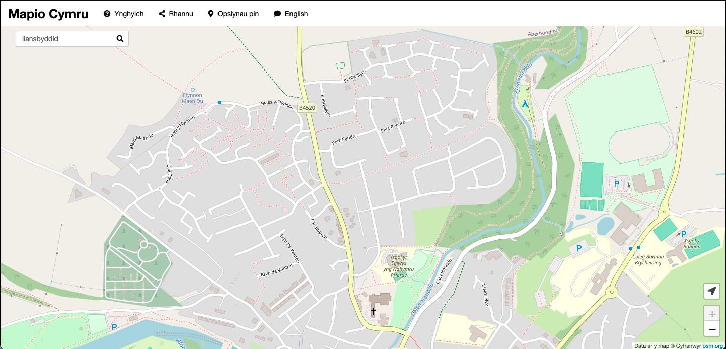
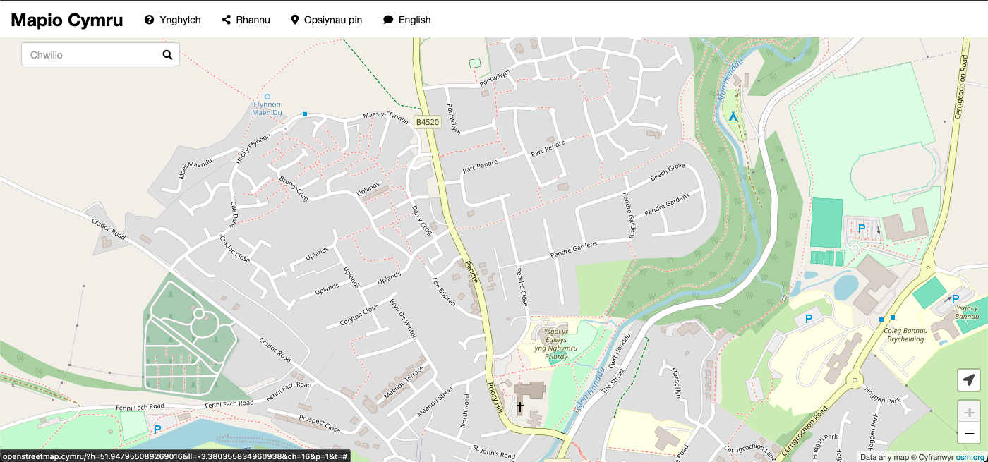
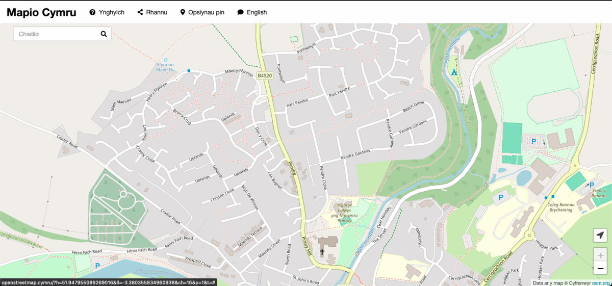
In other words you can show our map tiles, which are the PNG images available through openstreetmap.cymru.

Then you can do whatever your system allows such as panning, zooming, and perhaps putting pins, shapes, images and other things on the map.

Embed

Before we press ahead, everything that follows is aimed at somebody who is comfortable coding, maintaining a system, or using GIS software.

If you DON’T want to work directly with the base map it’s possible to embed Mapio Cymru on a website. This is probably the fastest and simplest method. It’s very similar to how you would embed video players etc (using an iframe).

Go to openstreetmap.cymru and click Rhannu/Share for details on how to do this. You can get an HTML embed code or alternatively a direct link to a specific view of the map.

Which systems?

The rest of this blog post will describe how to use Mapio Cymru as a base map, for people who want to be a bit more technical.

There are quite a few systems that offer to set a base map of your choice, such as things that run Leaflet.js, e.g. Overpass Turbo.

For example there are a few WordPress plugins that allow you to show maps on your website – such as Leaflet Maps Marker, WP Go Maps, and others.

If you have the skills you could create a website from scratch with Leaflet.js and use Mapio Cymru as a base map. Unfortunately the details on how to do this go beyond this little guide today, but there are guides on the web!

There is also desktop software that uses base maps of your choice such as QGIS.

For those interested Mapio Cymru’s CORS headers now allow direct use of tiles. Please note that some content management systems may show a security warning about cross-site scripting.

The all-important settings

Use the address below as the base map:

https://openstreetmap.cymru/osm_tiles/{z}/{x}/{y}.png

Also if you have to give levels of zoom, put 3 as the minimum and 16 as the maximum.

Here is an attribution or credit you should give, to fulfil the open licensing conditions of OpenStreetMap data. Here’s the HTML version:

Defnyddiwch <a href=”https://www.openstreetmap.cymru” target=”_blank”>openstreetmap.cymru</a>. Data ar y map &#x24BD Cyfranwyr <a href=”https://openstreetmap.org” target=”_blank”>osm.org</a>

Alternatively here’s the plain text version:

Defnyddiwch openstreetmap.cymru. Data ar y map © Cyfranwyr osm.org

Get in touch

If you have managed to get the map on your website or system, please leave a comment with the method you used – and a link to the specific page on your website if possible.

Terms

Please be respectful and reasonable with your use of the Mapio Cymru server. Get in touch if you want to discuss ‘heavy’ use, especially if you are an organisation, service, or project of significant size.

We’ll have to review how things go if demand grows.

Categories
Milestones

FixMyStreet are now using our map!

FixMyStreet is now available in Welsh


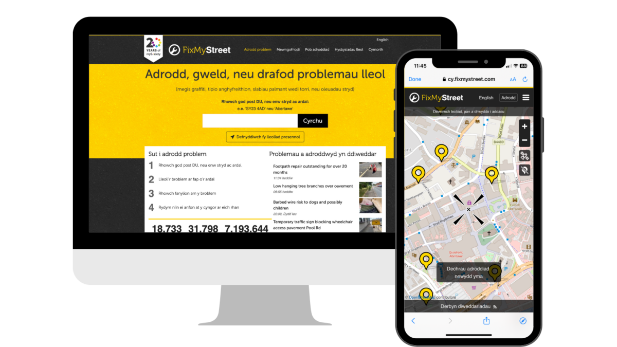
Welsh-speaking users of FixMyStreet, the national reporting service for local street and environmental problems, can now make reports using a Welsh-language map provided by Mapio Cymru.


Broken street lights, fly-tipping, potholes and other local, place-based issues in Wales can now be reported to the correct authority by citizens in Welsh as well as in English via FixMyStreet, the long-running reporting service for street and environmental problems provided by civic technology charity mySociety.


FixMyStreet is a progressive web app that enables citizens across the UK to report local problems to the authority responsible for fixing them, even if they do not know who that is. For the first time since its launch in 2007, users in Wales wanting to make reports in Welsh will be able to view a Welsh-language version of the website and app, including a Welsh-language map provided by Mapio Cymru.


Over half a million people in Wales speak Welsh and the Welsh Government aims to double this by 2050. Having digital services that work as well in Welsh as they do in English is key to achieving this growth in the language. Launched in 2019, Mapio Cymru is a project that aims to ensure mapping services are as good in Welsh as they are in English. Using open data sources Mapio Cymru provides a Welsh-only map of Wales. It also works with organisations across Wales to improve mapping services in the Welsh language.


Louise Crow, Chief Executive at mySociety, said: “FixMyStreet was built to make it easier for citizens to report problems in their communities. We are delighted to be able to make the service accessible to Welsh-speaking citizens, with a fully translated reporting process and a Welsh-language map, enabling users to select the street names and locations with which they are familiar. We look forward to seeing the Welsh-language version of the service put to good use by more citizens who care about improving where they live.”


Ben Proctor, Innovation Director at Data Orchard CIC which runs the Mapio Cymru project, said: “Digital mapping technology is really powerful and easy for organisations like mySociety to use in English. Sadly it’s not the same in Welsh. We aim to make it easier for organisations to  deliver services on the highest quality Welsh-language mapping available.”


Welsh-speaking users can start using the Welsh-language version of FixMyStreet straight away by heading to cy.fixmystreet.com or downloading the FixMyStreet app from the relevant app store.


There are gaps in Mapio Cymru’s Welsh language map because the project relies on volunteers and public bodies to contribute definitive Welsh names. Volunteers can help to plug the gaps by adding the Welsh names for features on the map (buildings, roads, mountains, fields and so on). Public bodies can help to plug the gaps by publishing the Welsh names that they hold for features under an open licence. The Mapio Cymru team is available to advise on these issues. Just visit mapio.cymru.

About FixMyStreet

FixMyStreet is an independent, free-to-use progressive web app, built by the charity mySociety to enable UK citizens to report, view and discuss local problems.


All reports made via FixMyStreet are sent directly to the authority responsible for fixing the problem, who can then reply to the report-maker to update them on the status of its resolution. Reports and their responses are also displayed publicly on the map to increase transparency within a community.


The software is available open source for use globally (see fixmystreet.org), or there is a fully hosted and integrated Pro version for which councils or other public authorities can pay an annual fee provided by the charity’s wholly owned subsidiary SocietyWorks (see societyworks.org).


About mySociety

mySociety is a non-profit organisation seeking to repower democracy, putting more power into more people’s hands through the creation of digital technologies and data. Visit mysociety.org for more information.


About Data Orchard CIC
Data Orchard CIC is a social enterprise helping organisations use data for better decisions and greater impact. Data Orchard CIC combines specialist skills in research, statistics and data with a passion for making the world a better place socially, economically and environmentally.  Visit dataorchard.org.uk for more information


Mapio Cymru is a Data Orchard CIC project. Visit mapio.cymru for more information.

Categories
Guides

Command-line tools for you to create an OpenStreetMap-derived base map in the Welsh language

All the custom code which we use for the Mapio Cymru Welsh-language map server is now available in a repository.

This will be of particular interest if you want to provision your own server which produces map tiles in the Welsh language (or perhaps a different language of your preference). All code is licensed under GPL, allowing you to run it for any purpose, modify it, and redistribute it.

Please note that a basic knowledge of how to use the Linux command line is assumed.

The main tool is a Lua script called cartonamecy2name.lua which is run when importing data. It determines the name to be stored in the database, for any given entity on the map. OSM data is the main source for Mapio Cymru, particularly the name:cy and name tags, and also Wikidata name information via OSM’s wikidata tag. In editing these sources we also refer to open data from the Welsh Language Commissioner.

Many more details are given in the README file in the repository, including step-by-step instructions for use.

If you just want to use a Welsh-language map which already exists, ignore the above and head to openstreetmap.cymru!

Categories
Events

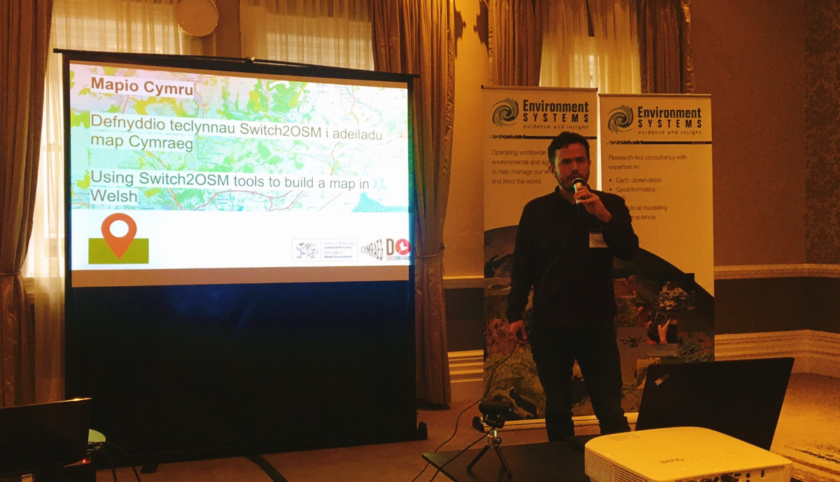
Mapio Cymru at FOSS4G: Using Switch2OSM tools to build a map in Welsh

It was a pleasure to take part in the FOSS4G conference today in Cardiff.

Here’s the recording of my talk about provisioning the Mapio Cymru server along with the slides.

This presentation will be of interest to people who want to advance mapping in lesser-resourced languages around the world. Then again, anybody with an interest in the overall growth of OpenStreetMap would do well to pay attention to the multilingual aspects of the project – in my view.

Thanks to the organisers and all participants for an insightful day at FOSS4G!

Categories
Events

Mapio Cymru talk at the FOSS4G conference

If you’re interested in the server software and data aspects of Mapio Cymru and OpenStreetMap, come to my talk at FOSS4G.

FOSS4G is the international Free and Open Source Software Conference for Geospatial. This year it is happening on Thursday 17th November simultaneously over several physical sites around Wales, Scotland, and England – including Cardiff where I will be.

As Mapio Cymru we’ve shared our learnings and enthusiasm at several events and organised a few of our own events, variously through the medium of Welsh and English. This time my talk will be through the medium of English. I am going to focus on the more technical side – what happens on the servers, plus some context about the Welsh language situation for those who might need it.

I’ll be discussing how we’ve built a map of Wales in Welsh, what technical and other challenges we’ve overcome, what the next steps will be, and share our overall vision for bringing mapping in Welsh to all.

Hopefully somebody out there will be inspired to contribute to mapping in the Welsh language or OpenStreetMap as a wider project, or start their own initiative – perhaps for another lesser-resourced language.

At the time of writing this I’ve just heard that the allocation of tickets for the Cardiff branch of the event is now running low. If you’re unable to get a ticket you can still watch the recording afterwards.

Categories
Milestones

New experimental map from Mapio Cymru to help you share more place names in Welsh

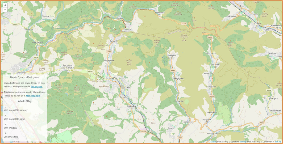
Mapio Cymru now has an experimental map you can browse, as a counterpart to the main map.

This map currently looks fairly similar to the main map, but it’s running on a separate server which I’ve provisioned for it:

pwlltywod.mapio.cymru

Look closely and you’ll see that all the place names are subtly different.

Why do this? The main purpose is to spot gaps in the data for names in Welsh. There are a few means by which a name can find its way to the main map. The map takes data from OpenStreetMap and Wikidata, and then processes it. We at the Mapio Cymru project wanted to convey the data source of each name on a map, but separately from the main map.

At the moment there are four potential sources noted in the experimental map’s key:

  • From the name:cy field (OpenStreetMap)
  • From the name field (OpenStreetMap) – while not labelled as being in Welsh the name looks as if it could be in Welsh, according to certain criteria. I need to blog about these criteria soon.
  • From Wikidata
  • No suitable name found (at the moment)

Please note that this key could change in future. Please refer to the map and its own key for details.

You won’t be able to do all the things that you can do with the main map, like search and easy embedding.

What you can do is browse the experimental map to find deficiencies and then edit OSM to enter names, in instances where the data is incomplete.

Your changes will appear on the main map and the experimental map.

Ultimately the place name you enter could then appear in a multitude of apps and projects, thanks to its licensing status as open data. I am very glad to offer this resource as a means of helping anybody who wants to share place names in Welsh. Thanks again to the Welsh Government for supporting this work.

The experimental map server is called the Pwll Tywod, or sand pit. This is denoted by the sandy coloured border. Our use of this term is to convey that we are playing with how it appears. Please excuse any occasional tech glitches you might see on the experimental map – but that’s the point.

Categories
Milestones

Mapio Cymru’s official map of Wales!

Mapio Cymru now provides Welsh language mapping data to Welsh Government’s Data Map Wales
Users of the Welsh Government’s digital mapping platform will be able to visualise Wales entirely in Cymraeg thanks to a new partnership. “Data Map Wales” is a Welsh Government service that allows people to search and visualise geographic data about Wales.
This data can be displayed on a choice of digital maps; and now one of these options is to see a map in Welsh. This service is provided by Mapio Cymru: a project that aims to ensure mapping services are available in Welsh as well as English.
Mapio Cymru has been providing a Welsh-language map of Wales for four years at openstreetmap.cymru but this is the first time they’ve provided Welsh Government.with their data.
According to Glyn Jones, Chief Digital Officer for Welsh Government, Mapio Cymru’s work with the new Data Map Wales team, “…is a flagship example of what we’re looking to achieve.”
He went on to say,
“it’s a really good example of good partnership working, ensuring a bilingual experience for the user”.
Speaking on behalf the Mapio Cymru project Wyn Williams said:
“This is an important step towards allowing people to access digital mapping in Welsh as easily as they can in English. We’re delighted to be working with the Data Map Wales team to support their services in Welsh.”
“The Welsh-language map is not as data rich as the English-language maps available from, for example, Ordnance Survey, because of the difficulty of accessing accurate Welsh-language mapping data. Mapio Cymru is working hard to increase the amount of Welsh language mapping data available to all.”
Mapio Cymru is a project hosted by Data Orchard CIC and part-funded by the Welsh Government’s #Cymraeg2050 project that works towards supporting a million regular users of Welsh.
Note to editors:
For more information, or to interview Ben Proctor of Data Orchard, openstreetmap.cymru’s web developer Carl Morris and/or Wyn Williams, Welsh lead for mapio.cymru email post@mapio.cymru 

IMAGES

This is Data Map Wales:

This is how to select Mapio Cymru on Data Map Wales!

Mapio Cymru on Data Map Wales!

Categories
Projects

The state of Welsh-language mapping

We worked with Transport for Wales to investigate Welsh language mapping, geolocation and route finding. This is what we found.

Mapping in Welsh

Transport for Wales asked us to undertake a piece of research for them. They wanted to know how they could build online mapping applications that treated Welsh and English language equally.

We’ve been thinking about these issues for several years and we maintain a Welsh language map of Wales at openstreetmap.cymru This, however, was a real opportunity to think about these questions from an organisation providing public transport services across Wales. We’ve produced a report for Transport for Wales which has a lot of detail in it and is very focused on their specific circumstances. This post is an opportunity to take a step back and think about some of the key things we have learned.

Digital mapping is really commodified… in English

If you want to spin up a transport application with slick background mapping, geo-location, route finding and lots of points of interest there are many robust options available. For many uses digital mapping applications can be rapidly assembled, at least in part, by stitching together commercial services that provide data on demand (for a fee).

For those of us on the team who remember when they had to drive to a mini-Computer in Cardiff to do some fairly simple GIS tasks this is really impressive. When you want those results in Welsh it suddenly becomes much harder.

Google Maps does not support Welsh… but…

Google Maps does not officially support Welsh.
This means that if you are a developer wanting to create an online mapping application using the Google Maps APIs you can’t ask for the data to be provided to you in Welsh. That should rule it out for most uses by public bodies in Wales. But… Google Maps does use Welsh in interesting ways. It seems to perform on-the fly translation. For example: it knows that Prifysgol is the same as University and so if you search for Prifysgol… it will offer you universities not just in Wales but across the World. We searched for a pub called the Black Horse and were offered the Ceffyl Du. This is quite clever.

If you use Google Maps on your phone with your locality set to Cymraeg you will see Welsh place names on the map, including in England. But without official support there are real limits to where it should be used.

Bing surfaces a lot more Welsh than we had realised

Bing Maps is Microsoft’s mapping platform. I’m sure they wouldn’t like to be de-scribed this way but I think most of us would say they are “Microsoft’s version of Google Maps”.

Unlike Google Maps, Bing Maps does officially support Welsh. As a casual user of the Bing maps website you might not notice this but as a developer you can amend your API calls to request responses in Welsh. Overall a developer can surface a great deal of Welsh in services from Bing maps. At most zoom levels roads will have bilingual names (rather than the Welsh name or the English name) and there are some odd gaps.

If you have very simple requirements for displaying points on a background map of Wales that won’t be dominated by English-language names Bing Maps is certainly worth a look at.

We feel that most public bodies could probably go beyond what Bing offers however.

Ordnance Survey could do better

Public bodies in Wales can use Ordnance Survey data under the Public Sector Geospatial Agreement. Ordnance Survey data is of extremely high quality and they offer a range of data downloads and APIs to support public bodies in their work.

But the way OS handles Welsh could be much improved.

OS publishes tiles: essentially electronic versions of the OS maps we are familiar with from walking trips. These include Welsh and English language names but OS policy means that English language names are more likely to appear than Welsh language names. It is not possible to request tiles that show only Welsh language names or where Welsh language names are more likely to appear than English language names.

OS also provides other datasets. Some of these contain the Welsh and English language names for features but we found that often the way that the data is labelled in the datasets made it difficult to identify what was the Welsh language name and what was the English language name.

Some of these are data quality issues, others are policy issues. Hopefully public bodies in Wales are working with OS to see improvements in these areas.

The “official” name

In many cases there isn’t an obvious, official source of the English language name and Welsh language name for a place, for a stream, a forest or an area.

This makes it hard to measure how good the coverage of a map is. There simply isn’t a “correct” dataset to compare it to. In many ways this is one of the strengths of the Welsh language, it truly is a living language and things are called what people using the language call them.

That said, computers need rules, and as we use maps on computers more and more the need for some rules around Welsh language names grows.

Our Welsh language map is based on the community edited OpenStreetMap and Wikidata databases. Our researches suggest that these datasets are likely to remain part of the mix in terms of naming places and features until, at least, commercial competitors catch-up. We really encourage people to contribute to these datasets.

Overall

At the time of writing:

  • It is very straightforward to build web mapping applications in English.
  • It isn’t at all straightforward to build web mapping applications in Welsh. It is possible to build them in Welsh though.
  • We’d like to encourage public bodies and other organisations serving the people of Wales to look into how they can build bilingual mapping applications. The more organisations working on this problem the more solutions will be developed.

We will carry on working on this area and we would love to hear from others with questions or ideas about welsh language and bilingual mapping.

We’d like to thank Transport for Wales for commissioning this work and for allowing us to share this summary of things we found as a result of this project.

Categories
Sylwebaeth

(Cymraeg) Enwau Cymraeg am adeiladau Gradd I o Fôn i Fynwy – eich cyfraniad plîs!

This entry is only available in Cymraeg.