Plugging the gap
A key objective of the Mapio Cymru project is to help increase the amount of names in Cymraeg (Welsh language) held by OpenStreetMap as open data, as a resource to support mapping apps and services available in Cymraeg in the future.
The biggest single gap in name data in OpenStreetMap in Cymru (Wales) is road names that should be used in Cymraeg. This data is held by all local authorities and passed to GeoPlace who use the data in the National Street Gazetteer. GeoPlace also supply the data to Ordnance Survey for inclusion in relevant products.
OS Open Roads and the National Street Gazetteer
The OS Open Roads dataset contains name data and is coded to provide the appropriate name in English and Cymraeg. When examining this product the Mapio Cymru team has been concerned to see inconsistencies in the data and what seem like data quality issues compared with on-the ground signage. For this reason we resisted using OS Open Roads as a source until we could understand these inconsistencies and judge whether they were significant.
The authoritative dataset for road names should be the National Street Gazetteer (NSG). This is available to public bodies under the PSGA but it is not easily available to third parties to view or to re-use.
Comparing OS Open Roads to the National Street Gazetteer
We signed a sub-contractor agreement with Welsh Government and they obtained a version of the NSG for Wales. They supplied us with a simple CSV consisting of Unique Street Reference Number (USRN), name in Cymraeg and name in English.
We joined this dataset to the OS Open Roads product and this gave us the opportunity to compare name data between the datasets.
For all of Cymru, where a name value appears in OS Open Roads it is an exact match for the values in the NSG 66% of the time.
On the face of it this is a worrying error rate. To dig into this we filtered the data to include only Powys roads.
In Powys, where a name appears in OS Open Roads it is an exact match for the values in the NSG 73% of the time.
Of the cases where a name appears in OS Open Roads but is not an exact match for the values in the NSG:
- 32% are simply different names and it is difficult to infer any reason for the difference
- in 27% of cases the NSG contains a description rather than a name.
For example: USRN 85320327 appears as “PRIVATE STREET MAES MAESMAENDU TO MAES-Y-FFYNNON LINK ROAD” in Cymraeg in NSG and “HEOL Y FFYNNON” in OS. The OS dataset does seem to contain street names that appear on physical signs but don’t appear in the NSG. Presumably this is down to OS surveyors adding the on-the ground data. - in 18% of cases it appears as if there are data quality issues on the OS Open Roads side. We can’t be sure, of course, but this is an educated guess
For example: USRN 85318006 appears as “CLOS BURGESS” in Cymraeg in NSG and “BURGESS CLOSE” in OS Open Roads - in 14% of cases the difference between the NSG and OS Open Roads is down to different application of spaces, hyphens, apostrophes etc
For example: USRN 85319893 appears as “DAN Y CASTELL” in Cymraeg in NSG and “DAN-Y-CASTELL” in OS Open Roads - The remaining 8% of cases were a mix of various other issues.
OS Open Roads is good enough
Having broken down these various differences we concluded that the OS Open Roads dataset is a good enough source for human editing. An editor reasonably familiar with road names in Cymraeg would be able to detect many of the problems and resolve them correctly.
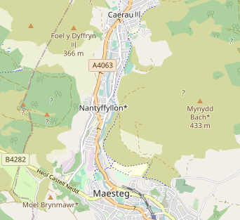
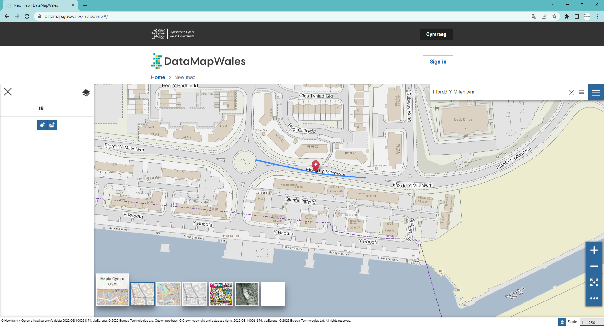
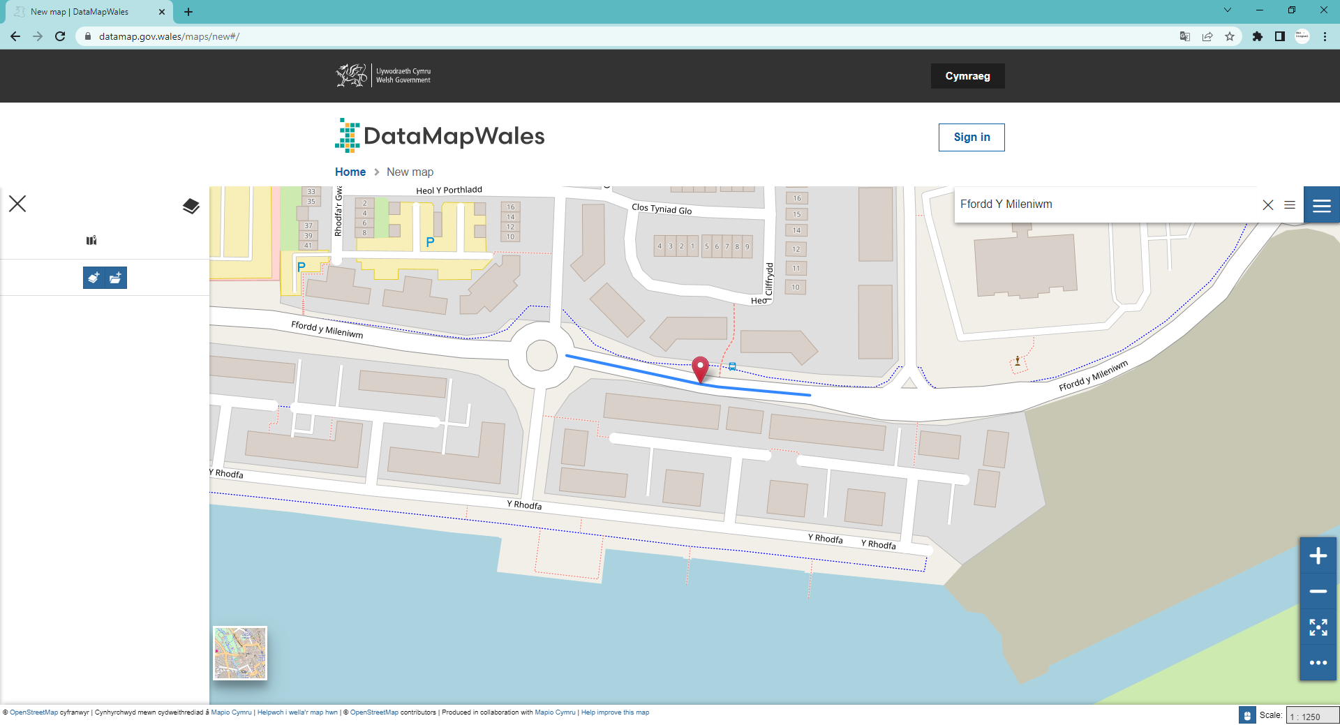
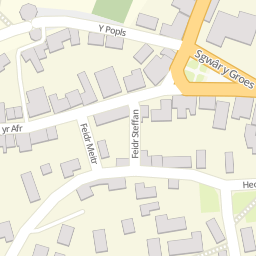
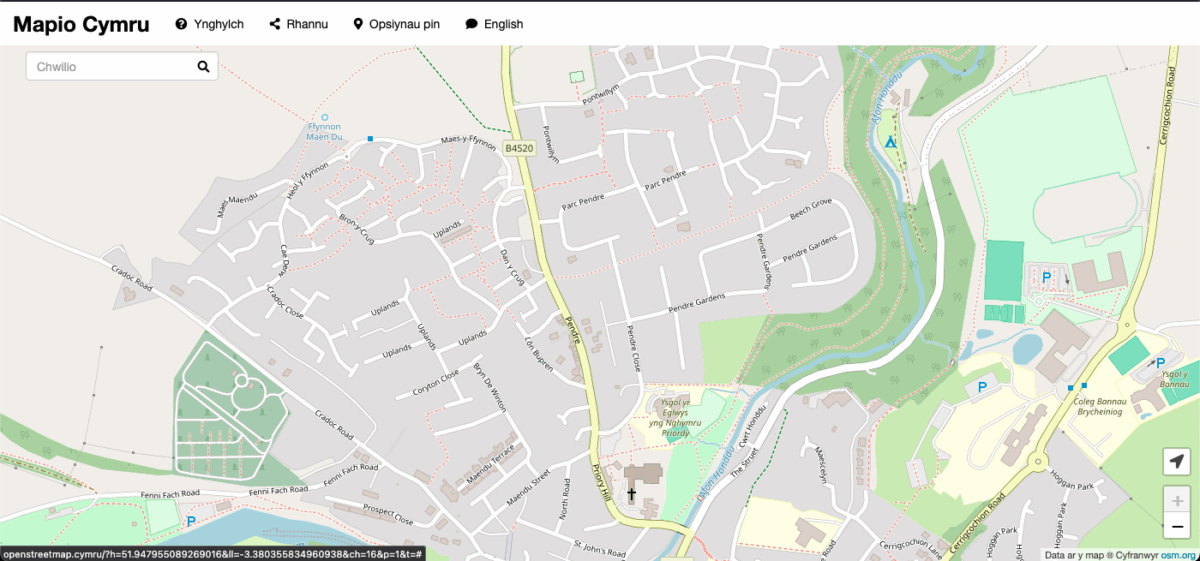
To demonstrate this we used OS Open Roads as a source to add Cymraeg names to roads in Aberhonddu, Powys.
This is what our map looked like before we started:
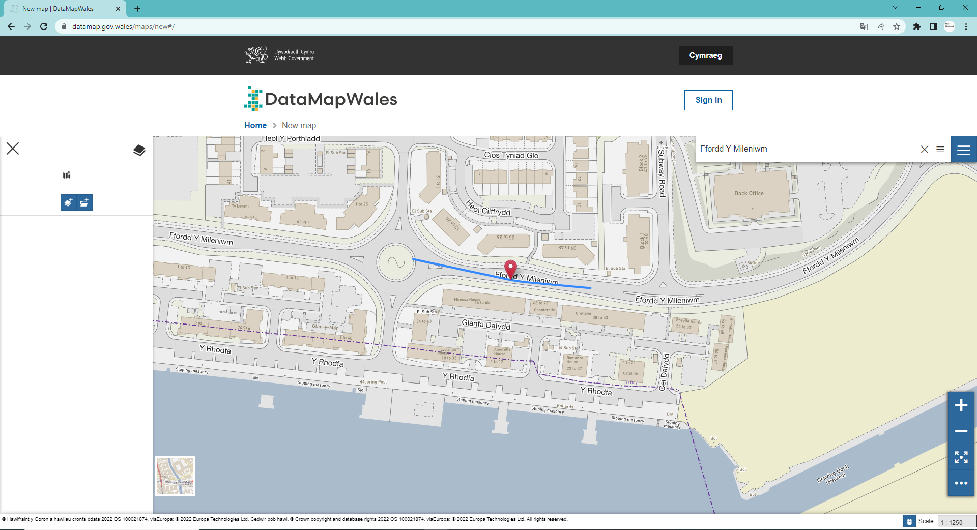
And this is what it looked like once we had added Cymraeg names:
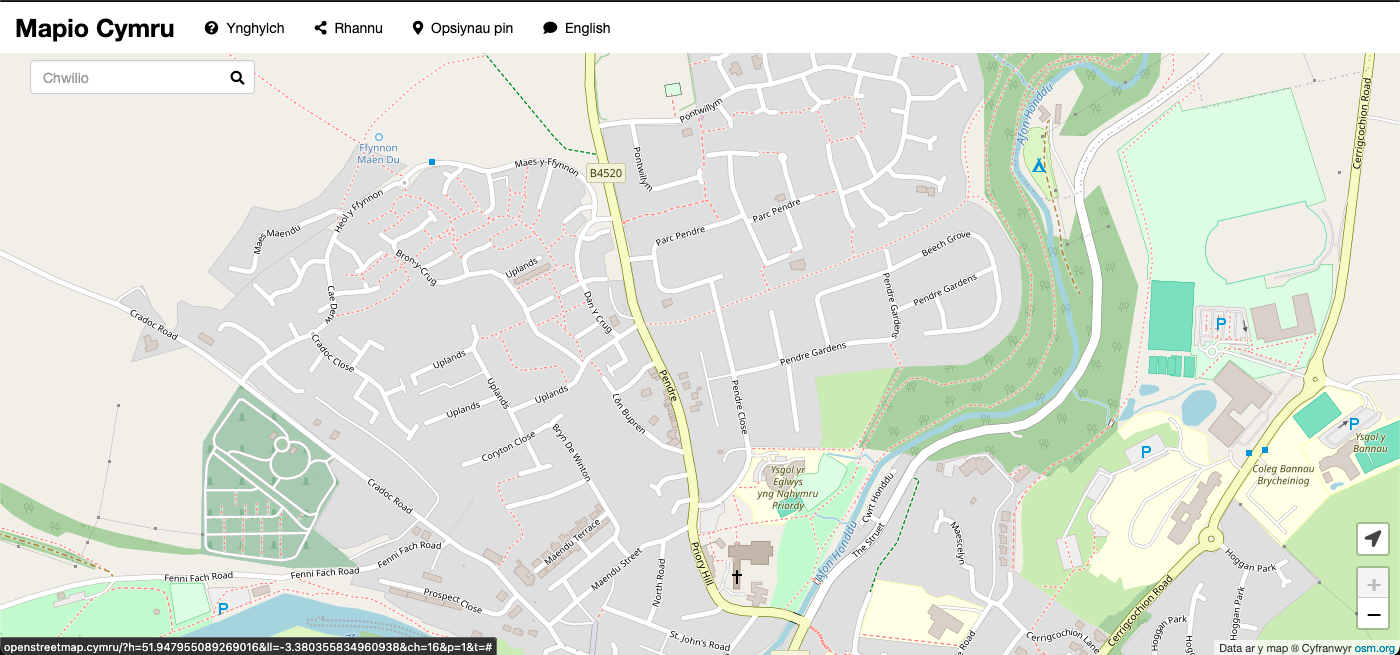
Lots more road names.
One of the potentially jarring things about this process is that it adds a lot of English-language names to the map. Which, on the face of it, seems odd if we’re trying to improve a Cymraeg map.
The truth is that many English-language names are used in Cymraeg. When we generate our Cymraeg map (which we do every day!) we label features with the name by which they are known in Cymraeg.
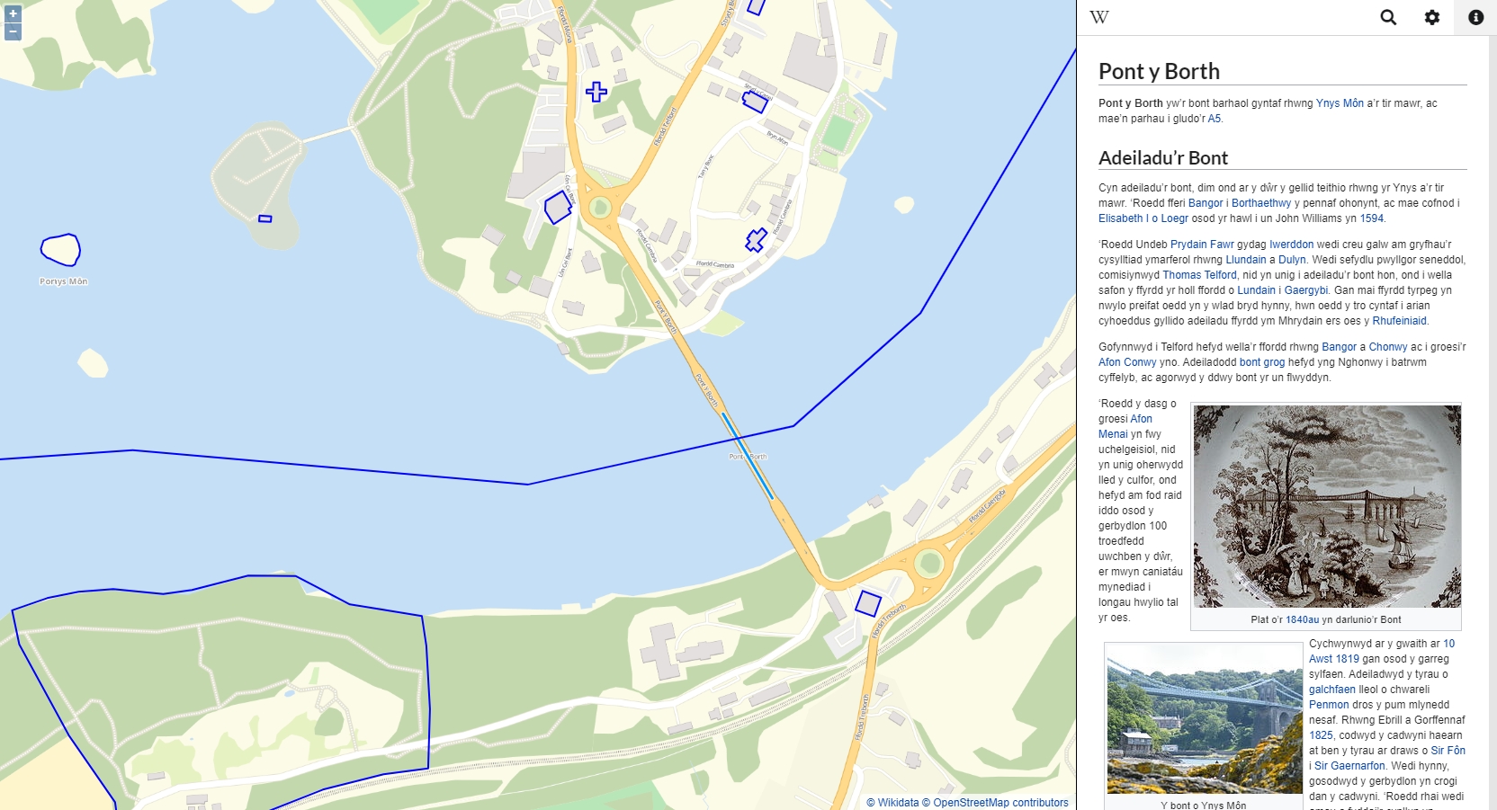
If we compare our map to the same view on the openstreetmap.org server which, in Cymru, tends to show the names used in English. We see that many road names are the same but not all.
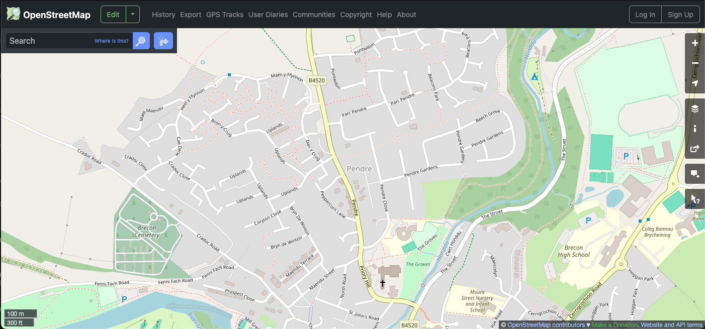
Notably Lôn Bupren appears on the Cymraeg map but appears as Peppercorn Lane on the English-language map. The other road names remain the same because they have the same name in Cymraeg and English.
This year we will be putting some effort into improving road name labels in OpenStreetMap.
If you are an OpenStreetMap editor please help us.